Jump To:
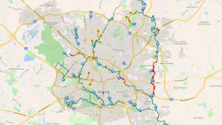
Capital Area Greenway (CAG) Explorer
Use the Interactive CAG Explorer Tool to:
- Find greenway amenities near you
- Quick links for Greenway Alerts and Reporting an issue on the trail
- How to Use Greenway Explorer
This web-based application allows greenway users to explore their location. Users can locate the nearest trailheads, parking lots, restrooms, bike repair stations, and more!
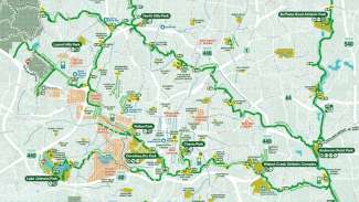
Greenway Map Download
The Raleigh Parks greenway map shows existing and planned (for less than 5 years) trails, parking areas with trail access, and select City of Raleigh facilities.
Download the current Raleigh Greenway Trail map.
This map is available at no cost and is available at community centers, our administrative office (located on the sixth floor of the Raleigh Municipal Building), by parkplan@raleighnc.gov, and by calling 919-996-3285.


